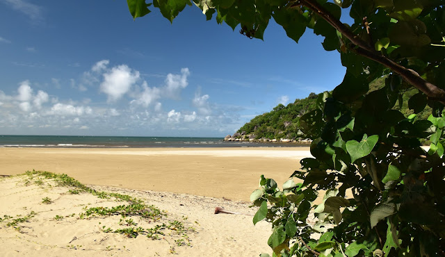
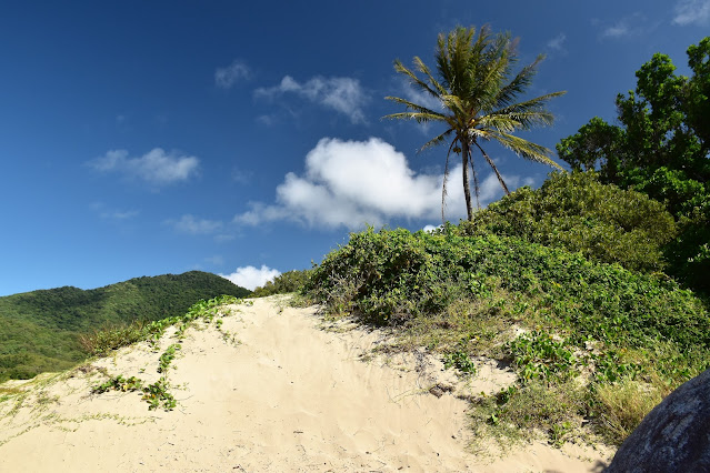
I had a bit of a climb as I walked between Finch Bay and Cherry Tree Bay - although the view made it worth the effort.
I'd climbed Mt Cook earlier in the day, so a bit of time soaking in the pool between the walks was appreciated.
We had the pool to ourselves today - we were visiting pretty early in the season up here.
Finch Bay.
The Finch Bay trail head featured the ubiquitous Saltwater Crocodile warning.
After hitting the sand at Finch Bay I swung left.
Once down on the sand I shuffled across to the massive boulders at the northern end of the beach and picked up the track that would take me over to my next objective - Cherry Tree Bay. I was a little surprised how high the track climbed as I made my way between the two bays, I definitely climbed enough to earn the short break that I enjoyed at the Finch Bay Lookout. After leaving the lookout I dropped down to the very pretty Cherry Tree Bay although my route only really touched the sand here before I left the beach and picked up the track climbing to Grassy Hill Lookout.
Finch Bay - with Mt Cook in the distance.
Leaving Finch Bay I climbed the headland over to Cherry Tree Bay.
I never got sick of this flora.
Dropping down to Cherry Tree Bay.
Cherry Tree Bay.
The climb up to Grassy Hill Lookout was a reasonably solid climb without ever getting too hard I thought. The first two thirds of the climb was along a very good walking track with the last third completed along the verge of the Grassy Hill Lookout access road. I'd been up to Grassy Hill years ago in the Troopie on our trip up to Cape York, however I'd never walked up here and to be honest I had little memory of the spot - even forgetting that there was a little lighthouse up here. As you'd expect Grassy Hill Lookout allowed for some stunning views up and down the coast and over Cooktown and the Endeavour River - there was even a view back towards Waymbuurr, which I'd climbed earlier in the day.
Another gnarly old Paperbark, this time on the climb up to Grassy Hill.
I got a similar photo years ago on my North West Circuit walk on Stewart Island in New Zealand - the temperature today was around 30˚ warmer though!
I'm about to swing right and follow at the Grassy Hill Access Road to the summit.
Grassy Hill Lookout.
The Endeavour River from the Grassy Hill Lookout.
Grassy Hill Lighthouse.
Looking down over Cooktown from the Grassy Hill Lookout.
Looking south along the coast towards Mt Cook from the Grassy Hill Lookout.
After enjoying some time on the summit I retraced my outward route back down the road and picked up the Cherry Tree Bay walking track. Instead of dropping back down to Cherry Tree Bay I was looking for a bit of a rough pad that would let me link up with a track near the botanic gardens and make my walk into a bit of a circuit. Where as the rest of the tracks along this walk were very well engineered and constructed this pad was very vague. After watching the map closely I picked up a very faint pad heading in the direction that I needed to be heading and plunged into the scrub. This pad was marked by the occasional old tape around some of the trees however it was another of those routes where I'd pause every now and again and ask myself where I would route the track if I was pushing it through.
After leaving the summit I dropped back down the access road...
... before picking up the Cherry Tree Bay Track.
Notice that all the arrows are pointing straight on - I went right!
This section of the stroll was pretty rough going.
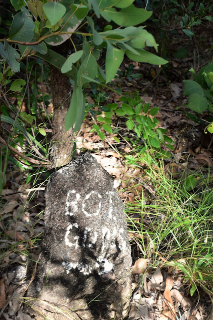
After awhile the pad split at a rock painted with the words 'bot gar' and I now started to drop fairly quickly, crossing some big boulders and passing through some rainforest along the way. After successfully getting off the hill without going arse up, getting lost or wearing an enraged Golden Orb on my head I emerged out of the scrub onto a good walking track again. I was now walking the botanic gardens to Finch Bay Track and the going was once again very good. My main memories of this section of today's stroll were of walking through a damp gully behind Finch Bay and passing through a beautiful Paperbark Forest. Arriving back at Finch Bay my circuit was complete and after exploring the bay a little more thoroughly I headed back in to town to reunite with Sam.
Once again I went right.
I was dropping fairly steeply now...
... however I soon arrived at the back of the Botanic Gardens and swung left.
Heading towards Finch Bay I walked through this nice gully...
... full of big old Paperbarks.
The Dirt.
According to my GPS I walked around 6.1 kilometres and climbed about 327 metres on what I'd call an easy-medium grade walk. This walk is a bit of a strange one in that the whole walk is along very good tracks - except for one section of around a kilometre which drops from the Cherry Bay Track down to meet the Botanic Gardens to Finch Bay Track, this link section needed a lot of concentration to follow. Both Finch and Cherry Tee Bays are beautiful spots however don't even think about swimming here as the area is prime Saltie country. I used some notes and a map out of the Woodlsane book Best Walks around Cairns & the Tablelands along with my Alltrails App and my GPS topos.
Relevant Posts.
Back down at Finch Bay again.
Finch Bay.
Late afternoon at Finch Bay.
Finch Bay Mangroves.
Sam's planning tomorrows activities while we enjoy our dinner on the deck at Cooktown - I wish I could fund this lifestyle forever!


No comments:
Post a Comment