
The Island Stack Cliffs from near Wild Dog Dreaming - I didn't take any photos at the actual art site as it's a sacred site.

This is another of the walks that heads off from behind the Boodjamulla Visitor Centre.


Yep, the bridge was a little on the short side.
After following Lawn Hill Creek downstream for awhile I arrived at the site of some rapids, this was going to be my crossing point. Lawn Hill Creek flows across a bit of a limestone rock choke here and the water varied between knee and waist deep, the biggest issue was that the bed of the creek is jagged rock full of hidden holes. Thankfully I managed to get across safely again (this was my third crossing on this trip to Lawn Hill) and once on the north bank I set off to find the Wild Dog Dreaming Track. There is a lot of flood damage here and with the walks on this side of the creek effectively closed because of the bridge issue then I think the QLD Parks folk aren't bothering with track clearing, whatever the case the going was a little rough initially.

Swimming the creek was an option...

... however I crossed some jagged limestone above some rapids.

I'm not sure when (or if) the bridge will be reinstated. Above these rapids is the shallowest spot to cross Lawn Hill Creek although a lot of care is needed here as the limestone below the surface is very uneven and full of potential ankle breaking holes.

Once across Lawn Hill Creek the red bluffs of the Island Stack started to tower overhead.

Lawn Hill Creek flood zone.
Once I'd left the Lawn Hill Creek flood zone the track got a lot more defined and easier to follow, although it was still sometimes very overgrown - this was a bit of an issue as I'd worn my Tevas on this stroll due to the creek crossing and I was now brushing past Spinifex with my bare feet and shins. After tracking along the shaded eastern wall of the Island Stack I arrived at the Wild Dog Dreaming art site. The Waanyi Aboriginal People ask that visitors don't photograph the rock art here as it is an important cultural site that science has dated back for at least 30,000 years - so no photos, however I can say that there is both some nice stencilling and art work as well as quite a few engravings so it's definitely worth a visit.

The tracks on the north side of the creek were a little unloved on this visit.

Heading towards Wild Dog Dreaming.

Island Stack cliffs.

That's Wild Dog Dreaming in the distance, the traditional owners ask that people not take photos of the art.

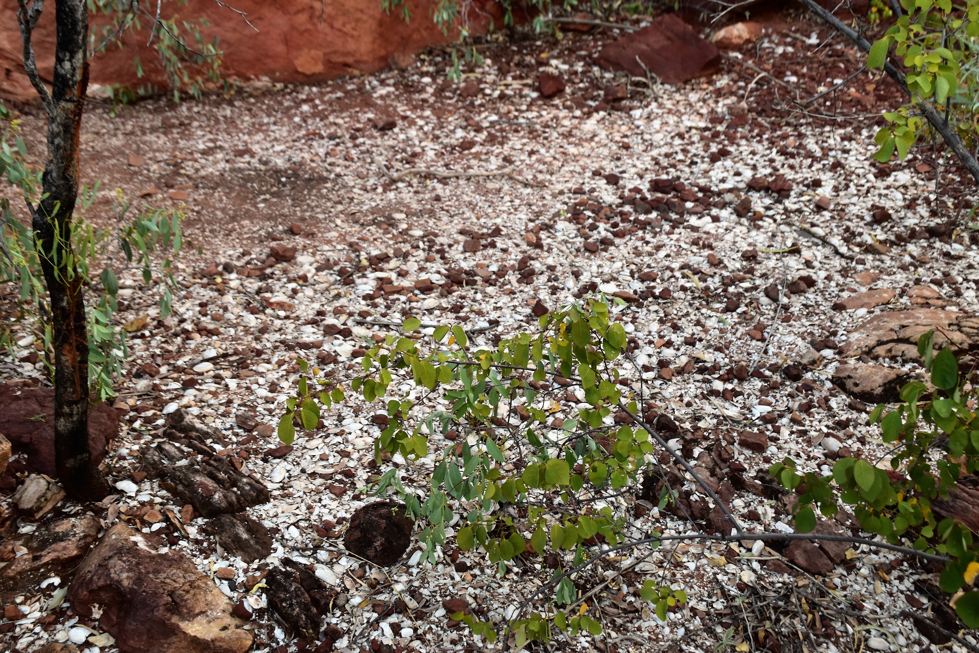
The middens below the art site give a fair hint on the previous occupation of this site.
Leaving the Wild Dog Dreaming site I took the short loop track down to the spot where Lawn Hill Creek enters the Lower Gorge, I was hoping to see some Freshwater Crocodiles here, however apparently the local population of freshies has been decimated by Cane Toads - so no crocs this afternoon (actually I didn't see a Freshwater Crocodile the whole time I was at Boodjamulla National Park on this visit). Following my overgrown track back to the Lawn Hill Creek ford I continued on along the creek for a few minutes before I picked up the start of the Island Stack Walk.

Lawn Hill Creek Lower Gorge.

I was hoping to see some crocs here this afternoon however I got nothing.

Like I said unloved.

Palm Trees lining Lawn Hill Creek.

Boodjamulla National Park.

I'm heading back to pick up the track that would allow me to climb onto the Island Stack now.

Back near the creek the going got rough again...

... however the scenery ramped up a notch.

Island Stack, Boodjamulla National Park.
Island Stack is a big lump of rock where Lawn Hill Creek used to split before rejoining at the Lower Gorge, due to a tufu dam being washed away in a big flood it's meant that the left hand branch of the creek now only really flows well under flood conditions (that's the old Cascades side of the creek) so it's barely an island now. While it might not be an island it still provided for some grandstand views this afternoon. Once up the very steep and airy climb on top of the stack I swung right and started a fairly long circumnavigation of the plateau like top of Island Stack.

I was heading left - thankfully while the flood debris looked pretty ugly it was fairly easy to get around.

The climb up onto the Island Stack was steep and fairly loose, as is pretty standard here the views more than made up for the pain though.

The top of the Island Stack is fairly flat.

I now followed a track that circumnavigated the plateau in an anti clockwise direction - the views along this track are sensational.

That's the Constance Range on the other side of the valley - I was up there about this time yesterday.

Nice walking on the Island Stack Track.

There was no way that I was going to make it back before dark tonight.

Lawn Hill Creek Lower Gorge.

Lawn Hill Creek Lower Gorge.

Lawn Hill Creek Lower Gorge.
After leaving the Lower Gorge Lookout I started to follow the western edge of the Island Stack escarpment, the views now starting to feature the Middle Gorge and the camping area. It wasn't only the gorges that were looking good tonight, the golden Spinifex, Ghost Gums and red rocks lit up in the soft early evening light all demanded my attention. With the light pretty well gone I completed my Island Stack loop and retraced my route steeply back down to Lawn Hill Creek. Once under the canopy of palms and pandanas around the creek the light disappeared completely and I pulled out the head torch for the last crossing of Lawn Hill Creek. With the light from the head torch reflecting off the surface of the water I was very careful on this crossing, although I have to admit the feeling of the cool water on my spinifex scared lower legs meant that I wasn't in a hurry to get out of the creek anyway. After crossing the creek I shuffled back to camp where I dropped my pack and ahead straight for the gorge to go for a final swim and wash the dirt and sweat off me. This was the last night on this visit to Boodjamulla National Park - hopefully it's not more than twenty years before Sam and I can return to this magic spot.

Up on the Island Stack in beautiful early evening light.

Lawn Hill Creek Middle Gorge and camping area from the Island Stack.

My shins and ankles copped a bit of trauma from the overhanging Spinifex.

Ghost Gums and Spinifex on the Island Stack.

Island Stack, Boodjamulla National Park.
The Dirt.
According to my GPS I walked around 6.1 kilometres and climbed about 129 metres on what I'd call a medium-hard grade walk. Apart from the baking heat the things to consider about this stroll is the crossing of Lawn Hill Creek - it's rough and you will get wet, maybe very wet! The other thing to consider is that (as of late April 2022) the tracks on the north side of Lawn Hill Creek aren't getting any love from the rangers and are starting to get pretty overgrown in spots - they are still followable, however in spots you may not be on the exact route, this is particularly so along the flood zone on the north side of the creek. I used an Alltrails Map and my GPS topos this afternoon.
Relevant Posts.

My steep and loose descent off the Island Stack - the photo doesn't show it however it was virtually dark now...

... although it did get one last photo of the glowing Island Stack cliffs.

Crossing Lawn Hill Creek by head torch required a fair bit of caution.

Sam and I enjoyed our last night at Lawn Hill watching the stars and satellites through the mesh of our tent.


No comments:
Post a Comment