
This morning was arguably the best walking that I've enjoyed since the plague hit us in early 2020.

I had a full moon to help illuminate my way along the beach.

Walking by the light of the full moon on Cape Bowling Green.
Once packed up I grabbed my pack and headed for the waterline where I hoped to make my escape from the mozzies - and to a large extent that plan worked. Once on the beach my eyes soon got accustomed to the low light that the full moon was giving me and the walking was pretty good. I had a really dodgy section of mangroves to negotiate shortly after hitting the beach which took me a little while to get through, although with the tide still at a reasonable height I managed to get through with either having to wade or going arse up on the slippery black mud. Once back on the dry sand I started the long march south as I watched the morning unfold before me. I reckon that I must of got lucky this morning as the sunrise was a peach with the beams of light radiating out into the blue dawn sky.

Pre-dawn walking out on Cape Bowling Green.
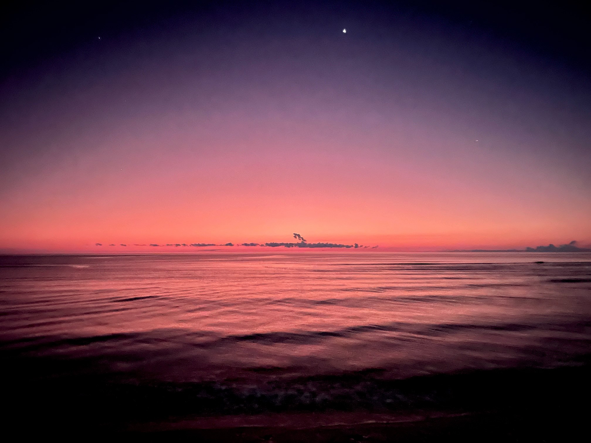
The sun is just starting to light up the eastern horizon.

The moon and the sun (well, almost) in the same shot.

Looking out across the Coral Sea.

This was the last of the phone shots. My phone works better than the DSLR (well the DSLR without a tripod) in low light.
By the time the sun actually made an appearance I was a good two hours into my walk this morning and I was getting close to the crux of the walk, a couple kilometres of mostly mangrove walking. So now I was keeping one eye on the height of the tide (and I was walking way higher up on the sand than I had on my way north yesterday afternoon) while at the same time trying to work out whether there was any dry ground on the mangrove lined section of coast ahead of me that I was now rapidly approaching - well as rapid as an old and overweight bloke can move on soft sand!

Once I broke out the DSLR progress got even slower!

Early morning walking down Cape Bowling Green.

Cape Bowling Green.


Looking back up the cape.

Approaching some more Mangroves.

Cape Bowling Green.

The sun has just made it's appearance - I was already about two and a half hours into my days stroll.
Arriving at the first really dodgy section I had some good news and some bad. I'll start with the bad, yes there was no way I was going to get through here with dry feet. The good news was that I was relatively confident that I could get through - and besides it was already stinking hot so a bit of a wade wouldn't be such a bad thing, well except for the crocs! Yes I was really on edge here, while the water only got a bit over my knee height and it was relatively clear it was still a fairly dodgy situation - I wouldn't say I was out of my comfort zone as I waded through the water however I was right on the edge!

Approaching the dodgiest section of mangroves (in the middle distance) - at least the sun was out now.

Cape Bowling Green.

Early morning on Cape Bowling Green.

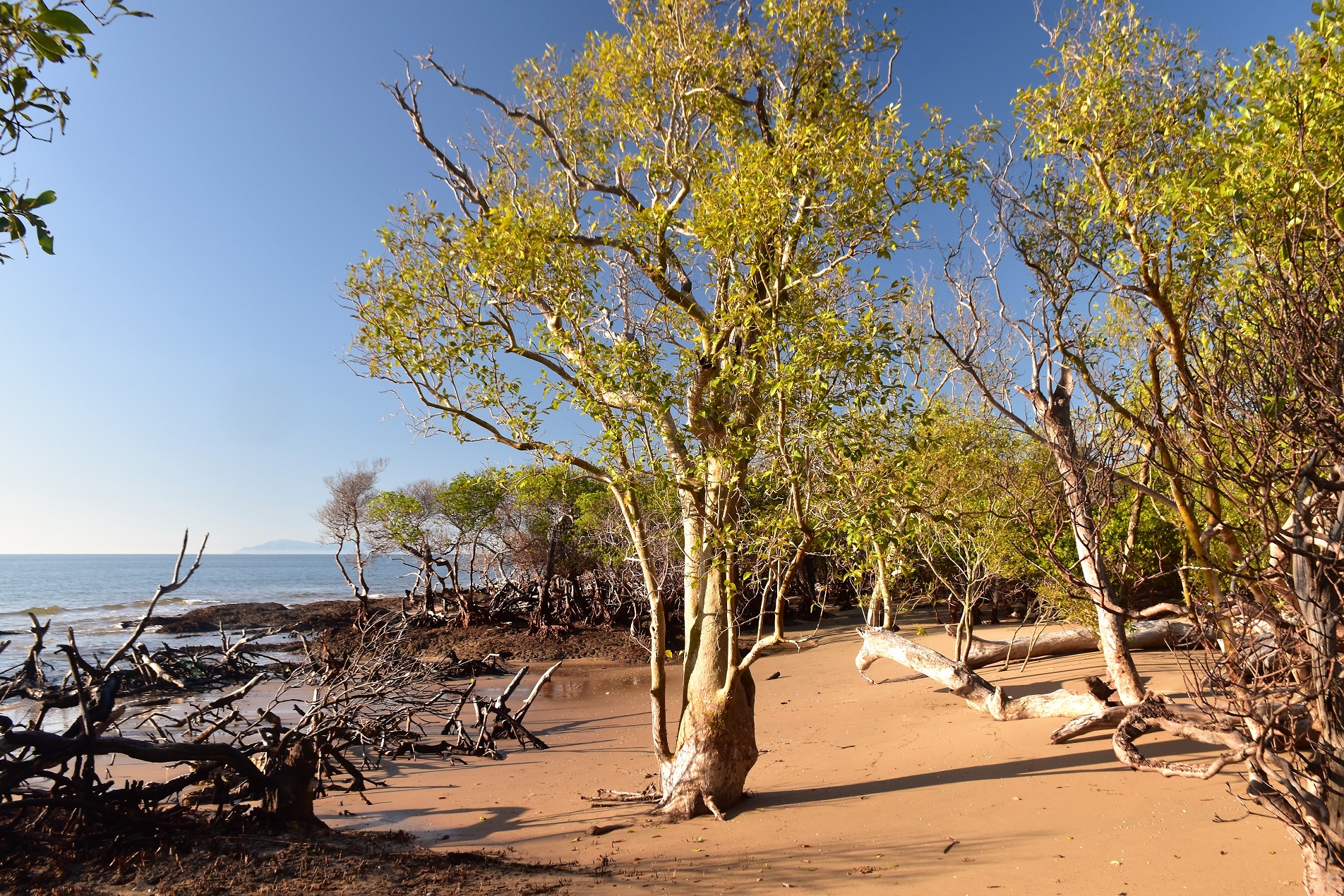
In between the gnarly mangroves I enjoyed walking these beautiful beach sections.

This stuff was as slippery as ice, although at least I wasn't walking in the water...yet!

This mangrove mud is probably the slipperiest mud that I've ever come across.

Following a quad bike track for awhile.
The go here was to look carefully for a quad bike width clearing in the mangroves - sometimes there was a bypass and sometimes there wasn't.

This was certainly easier than walking the mud.
When I'd walked this section yesterday I'd found the first couple of dodgy sections heading north had a rough quad bike path through the mangroves up away from the waterline so I was scouting around a little looking for some kind of a rough track. After passing by a couple of half buried and rusted 4wd vehicles that had been claimed by mangroves I found a vehicle width opening in the mangroves, yes it looks like the occasional fisherman do try and negotiate this section of the coast line. The bad news was that even though I had a clear run the 'track' was still well and truly under water although on the positive side at least I was walking on a sand base now and not slippery black mud. Once I'd found this old track it all seemed to come together for me, I soon found the rough quad bike track higher up on the dry ground which I was able to weave my way through the trees to eventually emerge onto clear sand.

Heading towards the last dodgy section.

I had to wade through bits of this section.

Hmm...

It doesn't look at all dodgy, does it?

I had some sandy openings to follow sometimes...

... however in other bits I was in the water again.
Emerging from the mangrove forest I could see the lagoon near Alva in the distance. It was just on 9am now and I'd been walking for around four and a half hours, not to bad really considering a fair chunk was done in the dark, I'd mucked around a lot taking photos of the sunrise and I'd had to negotiate some gnarly mangroves. With the end of the walk in sight I shuffled my way down the last couple of kilometres, meeting my first people since I passed by the boat ramp yesterday, once again back at the boat ramp. Somewhat ironically I had the deepest wade of the whole walk around twenty metres before finishing off the walk as I had to wade into the lagoon to bypass a fallen tree, although I was heading for a cold shower in a couple of minutes so this wade didn't really worry me too much. After crossing the coastal dune I arrived back at the Alva Lifesaving Club and finished my walk. Dropping my pack under the picnic shelter I enjoyed a cold beach shower while waiting for Sam to turn up to pick me up - and life suddenly felt a lot more comfortable.

Reaching the Pandanus at the end of the mangroves.

Fresh quad bike tracks meant that my mornings stroll was almost over.

I'm thinking that the fishing in the lagoon at Alva must be pretty good.

Walking along the Alva Lagoon...

... I actually had the deepest wade of the day as I edged around the fallen trees.
The Dirt.
According to my GPS I walked around 16.1 kilometres and climbed about 70 metres on this medium- hard grade stroll. As I mentioned on the day one post, the mangroves are really what ramp up the degree of difficulty on this stroll, especially as I was in prime Saltwater Crocodile habitat. The full moon walking this morning was a real positive I thought, not only did it allow me to make some big kilometres - over 16 kilometres before 9:30am wasn't too shabby for an old bloke I thought! This walk is written up in Tyrone Thomas' old book 50 Walks in North Queensland World Heritage Wet Tropics & Great Barrier Reef which I studied before heading off I used my Alltrails App and my GPS topos today.
Over the two days of this walk I walked around 39.6 kilometres and climbed about 200 metres on what I'd call a medium-hard grade walk. This walk isn't as easy at it seems on paper, everything from drinking water to tides to heat needs to be thought through. Apart from some the washed up flotsam and jetsam there are a few clues that there have been people out here before, mostly in the form of wrecked vehicles and boats being claimed by nature - although there is a rough fishing shack way out near the end of the spit. There is also the automated lighthouse and some other communication facility near the tip. For the most part though once you enter the Cape Bowling Green National park you'll be on your own and need to be totally self sufficient until you return.
Relevant Posts.

After almost 40 kilometres that's my exit point.

Looking back over Alva Lagoon - I'm thinking that I'll find myself back here one day.

A cold beach shower, a picnic shelter and toilets - I had everything I needed as I waited for Sam to arrive from Townsville.


No comments:
Post a Comment