
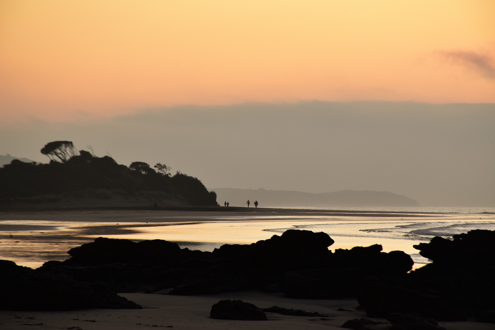
It took quite awhile to knock off the first 4 kilometres today - this is why!

I arrived down at Anglesea just as the first light started lightening the eastern horizon.

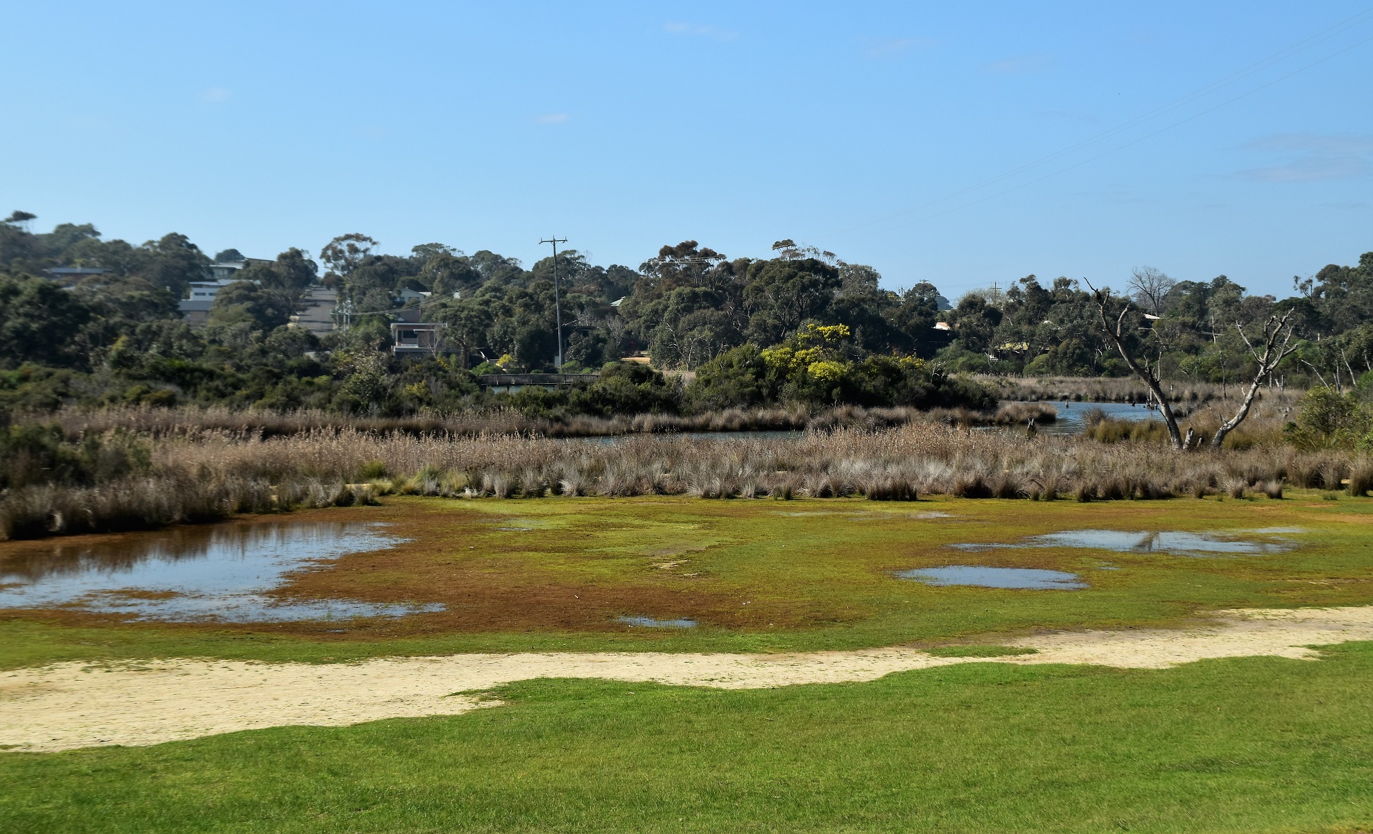
Anglesea Inlet.

Anglesea Inlet

Anglesea River making a break for Bass Strait.

Anglesea Beach first thing this morning.

I was heading this way.


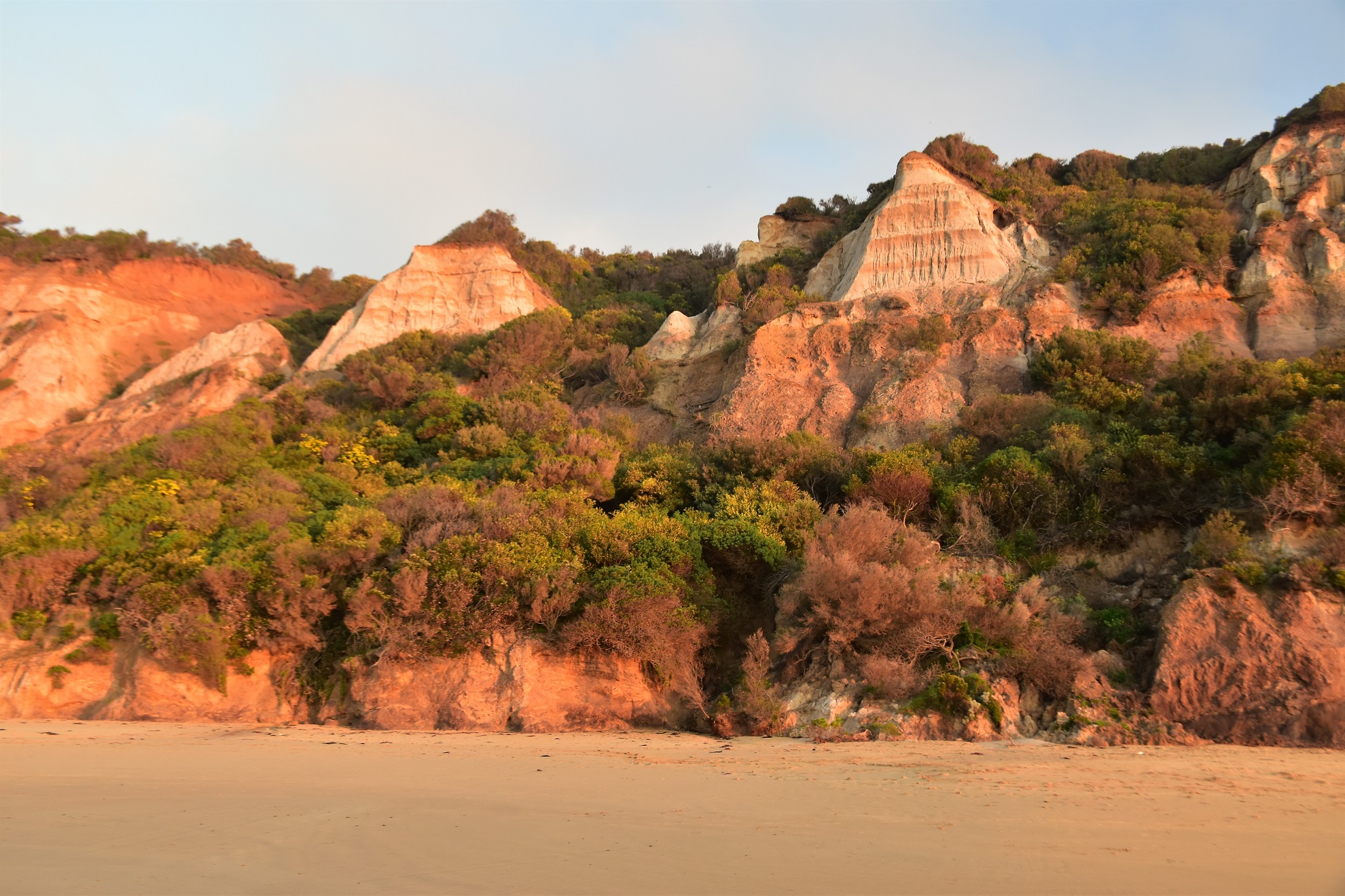
It pays not to get to close to these cliffs.

The sun has made it's appliance - I'd jagged a cracker of a winters day for this stroll.


After traversing Middles Beach I had a very easy scramble over Soapy Rock (which was indeed as slippery as soap) before I returned to the sand for the last short walk up towards Point Roadknight. Utilising a well signposted walking track I crossed over Point Roadknight and then again dropped onto the sand - I now had open beach ahead of me all the way down to Urquhart Bluff, about 4.5 kilometres away.
Middles Beach

Middles Beach

Middles Beach

Middles Beach

Looking down towards Point Roadknight from Soapy Rock.


The sun was now well and truly up now and the light conditions had evened out a bit so the beach section down towards Urquhart Bluff went a bit quicker as I wasn't mucking around taking as many photos. Having said that though the surging swell coming in off Bass Strait and the ever looming Urquhart Bluff still kept me happy as I trudged along the sand.

The Surf Coast Walk is well signposted where it crosses Point Roadknight.

Once I was walking the southern facing coastline the swell picked up.

Urquhart Bluff was still a smudge in the distance at this stage.


I could easily see the Aireys Inlet Lighthouse for much of this section.

There were quite a few surfers out near Urquhart Bluff this morning.

It was time to leave the coast and head into the hills.
Arriving at the car park at Urquhart Bluff I climbed away from the beach, and after a short break I set off on the inland section of the stroll. I was still following the Surf Coast Walk along here so it was easy enough to pick up the well signposted track as it climbed into the wind pruned coastal scrub at the back of the car park. After a fairly short climb the Surf Coast Walk levelled out and started to follow a very old section of the Great Ocean Road which allowed for a couple of longer range views, both back towards Point Roadknight and also across the coastal heath towards Aireys Inlet. When the Surf Coast Walk crossed an open area of gravel I swung off the signposted track and headed north a few metres to cross the Great Ocean Road. After carefully crossing the busy road I walked towards Aireys Inlet for a couple of minutes until I was past the a private property before I found a relatively open area of scrub (just over a small gully) where I left the road and set off north, across country. This little off piste link was only around 300 metres in distance and the fairly open heathland made for nice and easy walking really.

The track was again well signposted as it left the Urquhart Bluff car park.

The Surf Coast Walk climbed fairly easily up here.

I've just walked the length of that beach.

My short off piste section was actually pretty easy.
Emerging from the bush on Gilbert Street the great walking was definitely over for awhile now though. I was now going to be following a series of rough 4wd tracks back towards Anglesea and having walked these tracks quite a few times over the years I knew what was in store. While the scenery is nice enough along here (well, except for the old open cut, brown coal mine😦) it's the track itself that is a bit of an eyesore. Gilbert Street is a heavily eroded 4wd track that crosses Anglesea Heath and while it does allow for some good longer range views and some quick walking the eroded and muddy track itself is certainly not that aesthetically pleasing.

Arriving on Gilbert Street the good walking was over for awhile now.


Anglesea Heath.

Gilbert Street - not the most aesthetically pleasing walk!
After about 6 kilometres of walking along Gilbert Street / Mount Ingoldsby Road / Messmate Track I finally left the roads and dropped back onto a walking track that contoured high above the Anglesea Golf Club. I'm reasonably sure that this bit of the stroll was either an earlier alignment of the Surf Coast Walk or maybe a high tide variant, however now it looks like it's being used for a mixture of walking and mountain biking. After following a series of short tracks east I soon emerged back at the Angelsea River at the pirate ship in Coogoorah Park (the kiddies would love this spot I'm thinking). Now I was back at the river I just swung right and followed the river down stream back to the ute, the go along here was to utilise the closest track or road to the river and the only really dodgy bit of this section was when I once again had to cross the very busy Great Ocean Road.

After a fairly long road bash I picked up this nice single track that contoured above the golf course.

Back down on the Anglesea River near Coogoorah Park.
The Dirt.
According to Alltrails I walked around 17.55 kilometres and climbed about 324 metres on what I'd all a medium grade stroll I guess. This is really a walk in two parts, the coastal section is top class, the inland section is less so. If anyone out there is thinking of walking this route then be aware that the first 4 kilometres need to be completed on a fairly low tide as the water comes right up to the base of the unstable cliffs in spots at high tide. Another thing to consider is that there is a small off piste section that needs to be walked and while it's very easy it still needs a little navigational skill. I used notes out of the House of Chapmans book Walking the Otways as well as my GPS topos and my Alltrails App this morning.
Relevant Posts.

Anglesea River

Anglesea River - it was time to head off home after what was actually a pretty good walk.


No comments:
Post a Comment