
The Crater at Mt Hypipamee National Park is an old volcanic vent.
After spending more than a week baking in the desert heat in outback Queensland Sam and I headed across to the Atherton Tablelands for a few days to chase some waterfalls. Our visit to the wet tropics coincided with a unseasonable rain bomb hitting the area so we were now dealing with constant rain. Looking for something to do for awhile while Sam chilled out at out apartment at Lake Tinaroo I thought that I'd head out to Mt Hypipamee National Park and do the short walk out to The Crater and Dinner Falls.

It is a rainforest after all.

I had no luck toady on the Cassowary front - lots of Scrub Turkeys though!
Locking the ute I grabbed my umbrella, camera and set off into the dense rainforest to see what could see. The path out to The Crater is a sealed path that would be suitable for wheelchairs or prams and with me juggling an umbrella, a phone, a GPS and a DSLR I was glad the walking was pretty straightforward. It was only 15 minutes before I arrived at The Crater, this deep hole in the rainforest was a spectacular sight even in the wet and overcast conditions so I'm thinking beneath a blue sky it would look even better. The Crater is actually an old volcanic vent which now has a small water filled lake in the bottom of it 60 metres directly below the vertigo inducing lookout platform. Incidentally the water is thought to go down another 85 metres below the algae covered surface.

The Crater section of the walk is on a wheelchair standard track.

Mt Hypipamee National Park.

The Crater Track.

The lookout at the Crater is actually partially cantilevered out over the abyss.

The Crater.

The sheer walls of the Crater.

After safely getting a photo of The Crater without my trekking umbrella flying into the water I resumed my short journey. I now dropped down a rougher track to meet the headwaters of the Barron River at Dinner Falls. The river below the falls has a small weir which has created a nice swimming hole although with the rain still coming down swimming wasn't high on my list of things to do at the moment. Leaving Dinner Falls the track follows the northern slopes above the Barron River as it heads back up to the carpark, there are a couple of opportunities along here to photograph some more waterfalls and cascades although the national park folk ask that the punters don't jump over the lookout barriers.

Dropping down towards Dinner Falls I passed above this nice cascade.

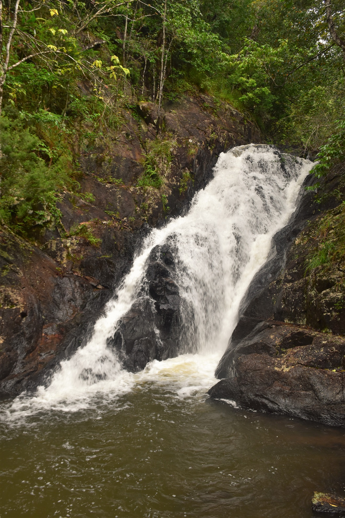
Dinner Falls

Dinner Falls

There is a small weir below Dinner Falls which would make for a decent swimming spot I think - although not today!

I had a bit of a climb away from Dinner Falls...
... although the Barron River with its numerous cascades was never far away.
The Dirt.
According to my GPS I walked around 1.7 kilometres and climbed about 78 metres on this very easy walk. The carpark has picnic facilities, a toilet and information boards. The track out to The Crater and back should be wheelchair friendly. This walk is written up in the Woodslane book Best Walks around Cairns & the Tablelands. I used my Alltrails map and my GPS topos on this walk.
Relevant Posts.

After one final climb...

... I re-joined the wheelchair friendly Crater Track.

Mt Hypipamee National Park.

My Alltrails App suffered from a bit of user incompetence!


No comments:
Post a Comment