Walking the Sunset Remote Walk beside Lake Becking.
It was pretty late n the day when I turned up at the Lake Becking Camp...
... we still had time to climb the dune behind camp for sunset though.
There is a lot of salt mining history at Lake Becking.
Lake Becking
By the time we woke up next morning, packed up and enjoyed brekky it was after 9am when we set off. The Sunset Remote Walk (SRW) starts at the Lake Becking Camp and the first signpost is on top of a dune, 15 metres from camp. After the obligatory 'start' photo we crossed the dune and dropped down to the edge of Lake Becking. Last time I'd walked here Lake Becking was completely dry however on this visit the salt lake was pretty well full of water, which was a nice contrast. The SRW contours along the edge of some dunes on the southern shore of the lake here, although walking the lakes edge was the more enjoyable option today.
We were actually up pretty early this morning...
... although by the time we actually set off the sun was a bit higher in the sky!
The start shot.
The only lake that we'd see on the walk was Lake Becking at the very start (or end) of the walk.
After we reached the western end of the salt lake we swung away from the lake (well it swung away from us actually) and headed into the desert. We now walked a sandy track generally west for a short while before our track intersected with an old north / south fence line which our track followed north...for a long time! Walking the old arrow straight fence line meant that we had to climb and descend a few reasonably sized dunes, although really the going was pretty easy until we reached Saltbush Flat and our first water tank. After enjoying a quick break we grabbed our packs again and once again continued our fence line walk for awhile longer as the dunes started to get slightly higher, passing our return route at a nice copse of native pines along the way.
After crossing Honeymoon Hut Track the SRW left the fence line and started a more meandering journey north and we also now started to negotiate some higher dunes that were interspersed with a few pleasant grassy flats. Unfortunately this section of the walk had been fairly badly cut up by motorbikes so not only were we climbing some of the biggest dunes of the walk but we were also negotiating some of the softest sand that we'd encounter...c'est la vie 😒
Lake Becking
Lake Becking is normally a bone dry salt lake so to see it with so much water was a little unusual.
Our route followed this old fence line for a looong time.
The Saltbush Flat water tank.
North of Honeymoon Hut Track we left the fence line and started a more meandering journey north.
We were now climbing up some fairly large sand hills.
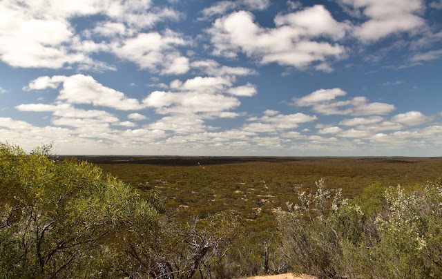
I think that maybe Mt Crozier in the distance.
Murray Sunset National Park.
Sunset Remote Walk.
Some of the steeper climbs were made a little harder by motorbikes cutting up the sand.
We'd been looking at some larger sand hills in the distance for awhile and guessing that one of the bigger hills must be Mt Crozier, so it was no real surprise as we found ourselves snaking along a high sandy ridge towards the biggest of them now. By the time we reached the Mt Crozier Lookout I was pretty cooked today (and as usual in our partnership Jo appeared to be doing it easy) although thankfully our camp was only a fairly short descent away. Actually our camp was so close to the lookout that after pitching the tents and eating dinner we were able to head back up to the lookout in time for sunset.
Looking down over our Mt Crozier Camp from the lookout.
Jo is dropping off Mt Crozier.
Apart from the water tank there are no facilities at the Mt Crozier Walkers Camp.
Mt Crozier Walkers Camp.
The Dirt.
We walked around 18.5 kilometres and climbed about 460 metres on what I'd call a medium grade days walking today. We were able to get water from tanks at Lake Becking, Saltbush Flat, the Mt Crozier 4wd Camp and also the Mt Crozier Walkers Camp (we contacted the local Parks Vic office before setting off to check the water levels). There are long drops at both Lake Becking and the Mt Crozier 4wd Camp. We had Telstra service from some of the higher spots today although you wouldn't want to be relying on a signal though. The walking is slightly harder than maybe imagined on sections of this walk as the sand has been badly cut up by motorbikes so that needs to be factored in - talking to the local ranger before the walk he said it was a ongoing problem. The walkers camp at Mt Crozier is remote from the 4wd Camp and has no facilities apart from the water tank and some flat ground - the long drop is a five minute walk away in the 4wd camp. We used John & Lyn Daly's notes out of their old book Take A Walk in Victoria's National Parks as well as our Alltrails App and GPS topos today, we were also carrying Meridian's Victoria's Deserts map.
Relevant Posts.


No comments:
Post a Comment