
Red Rock Trail.

Hmm.... this looked serious.

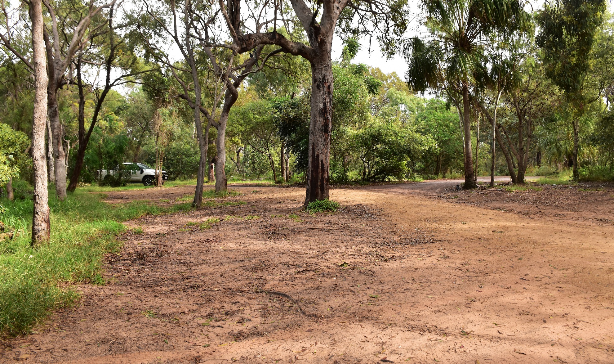
The track into the carpark wasn't too bad really.
I was a little surprised to arrive at the rough carpark at the end of the road and find around 12 vehicles scattered about as like I've mentioned already the weather today was average at best. Grabbing my camera I set off down the long boardwalk down to Springs Beach and it soon became clear why all the vehicles were in the carpark, they weren't walkers out traipsing along the coast they were surfers out enjoying the swell. Once I hit the soft sand of Springs Beach I swung right and headed for Rocky Point to watch the surfers for awhile before picking up the trail and starting my journey south.

The trail head is well signposted from the car park.

The section down to Springs Beach is pretty well all boardwalk.

The Springs Beach Humpy.

Rocky Point at the south end of Springs Beach seemed to be the go to spot for the surfers.

Today was more about the wild surf crashing into the rocks than beautiful scenery shots.

Rocky Point.

The view north towards Round Hill Headland (1770) from Rocky Point.
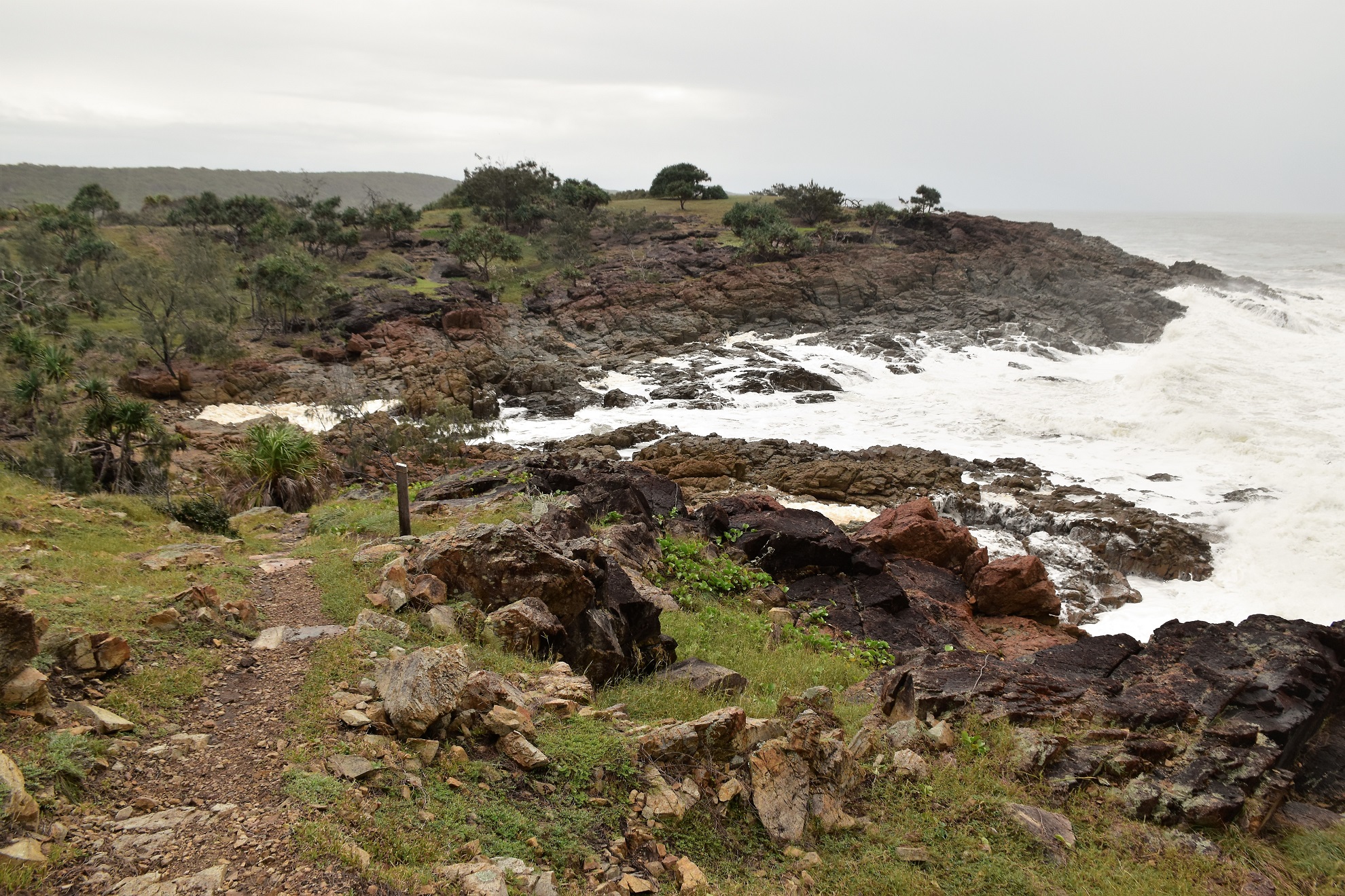
Red Rock Trail is named after the slightly unusual red rocks that make up the coast along here and ordinarily they would make for some nice photos I think, although today I was more interested in keeping my DSLR dry than composing great photos. After crossing Rocky Point, Red Rock Trail traversed a series of small beaches and headlands and while the beaches were sometimes a little soft the headlands made for nice walking, although the track was sometimes a little muddy and slippery. After walking Honeymoon Bay and Sunrise Beach the track arrived at the last beach of the walk.

The Red Rock Trail stays fairly close to the edge of the low cliffs...

... occasionally dropping down to water level to walk small beaches.

Red Rock Trail.

I'm about to drop down onto Sunrise Beach.

The further I walked today...

... the more the weather deteriorated.

Red Rock Trail.

The last beach that I walked doesn't appear to have a name however it was my longest beach walk for the day.

I was now climbing up onto that rocky headland.

It was a fairly easy climb - initially up the red rock before some open grassy slopes.

Looking back down along the beach that I'd just walked.


Time to head back to the ute I think.

And still the weather deteriorated.

There were no walkers around although I did have a White Bellied Sea Eagle for company for awhile.


Red Rock Trail.


I enjoyed a fairly relaxed walk back as I took the time to stop occasionally to get photos of Mother Nature doing her best walk on the rugged coastline - I'll probably never get back here again and if I did I doubt it would be in conditions like this. After carefully negotiating my way back along the slippery track I dropped back down onto Springs Beach again, the surfers that had been enjoying the swell at Rocky Point now all having headed back to their dry homes. All that was left now was to pick up the long boardwalk that I climbed away from the beach and back up to the ute - jumping into the dry cabin it was time to look for my next little adventure!

Looking back over a very foamy Sunrise Beach.

The Red Rock Trail dropping down towards Honeymoon Bay.

There were quite a few wallabies out and about near Honeymoon Bay.

The Red Rock Trail heading back towards Rocky Point.
The Dirt.
According to my GPS I walked around 8.7 kilometres and climbed about 222 metres on what I'd call an easy - medium grade walk. If anyone wants a slightly easier walk then avoid the climb onto the last headland and this would be an easy walk. The Red Rock Trail looks like it had a lot on money spent on it at some stage, however it seems to be getting a little rough around the edges now (that maybe because we have had a lot of shitty weather up here over the last six months), the track can be a little overgrown and muddy and the dry stone steps are sometimes very eroded. Lastly, this walk doesn't appear to be in a public park (it looks like Bush Heritage manage at least part of it) and for most of its length there are private, and very flash beach houses lining the coast. For the most part the private property is pretty unobtrusive however it pays to be aware of them when you consider stopping for a skinny dip - oh wait, that's just me! Speaking of swimming it would be possible along here, although obviously consider your own abilities before jumping into this un patrolled water. I used my Alltrails App and my GPS topos on the walk today.
Relevant Posts.

Back on Springs Beach - the sun was trying to break through.

If anyone wants a (very) easy walk then the boardwalk between the car park and Springs Beach would be a good option.

Ironically as I walked through the car park at the end of the walk the sun finally started to cast shadows.


No comments:
Post a Comment