 |
| Lake Hattah |
The Hattah Lakes National Park is one of my favourite spots in Victoria. Over the years I’ve spent many nights camped up here, either beside one of the lakes or on one of the many beaches along the meandering Murray River. There is something about the red sand, native pines, Red Gums and fresh water desert lakes that has obviously got under my skin as I just keep coming back up here. Whilst I’ve visited the area a lot I haven’t always done a lot of walking up here, sometimes I’ve just been cruising around checking things out in my 4wd and at other times we’ve been happy to just camp on the Murray River and kick back on the beach. The first time I walked in this part of the park was in the middle of summer with my teenage nephew, needless to say it was stinking hot so we ended up shortcutting the walk along Brockie Track. I’ve been back twice since then to attempt the complete walk but both times I’ve been thwarted by flood waters flowing between Lake Hattah and Little Lake Hattah, after checking out the Parks Vic site and finding no issues I figured that today was the day.
 |
| Our camp at Lake Mourpall, we didn't get here until 1:30am this morning. |
We’d only arrived at our camp at Lake Mournpall at 1:30 am this morning after the 7 hour drive from home, so it was a pretty relaxed start today. After breakfast at Lake Mournpall we packed up camp and headed across to the walk start at the Lake Hattah Campground. Like the Lake Mournpall Campground, Lake Hattah Campground was more or less empty, I’ve mentioned this before but it looks like the exorbitant fees as well as the need to pre book your site is stopping many people from enjoying these spots. A lack of people isn’t something that worries me too much though, but I do wonder if the punters aren’t visiting and falling in love with these spots then who is going to stand up and protect them when the need arises? As I’m writing this there is a push from some conservatives to give the environmental water needed to keep these ecosystems alive to irrigators due to the drought. In other wetland areas along the Murray logging of old growth Red Gums forests is an issue and in other areas salinity is also an issue. There is certainly plenty to worry about and fight for.
 |
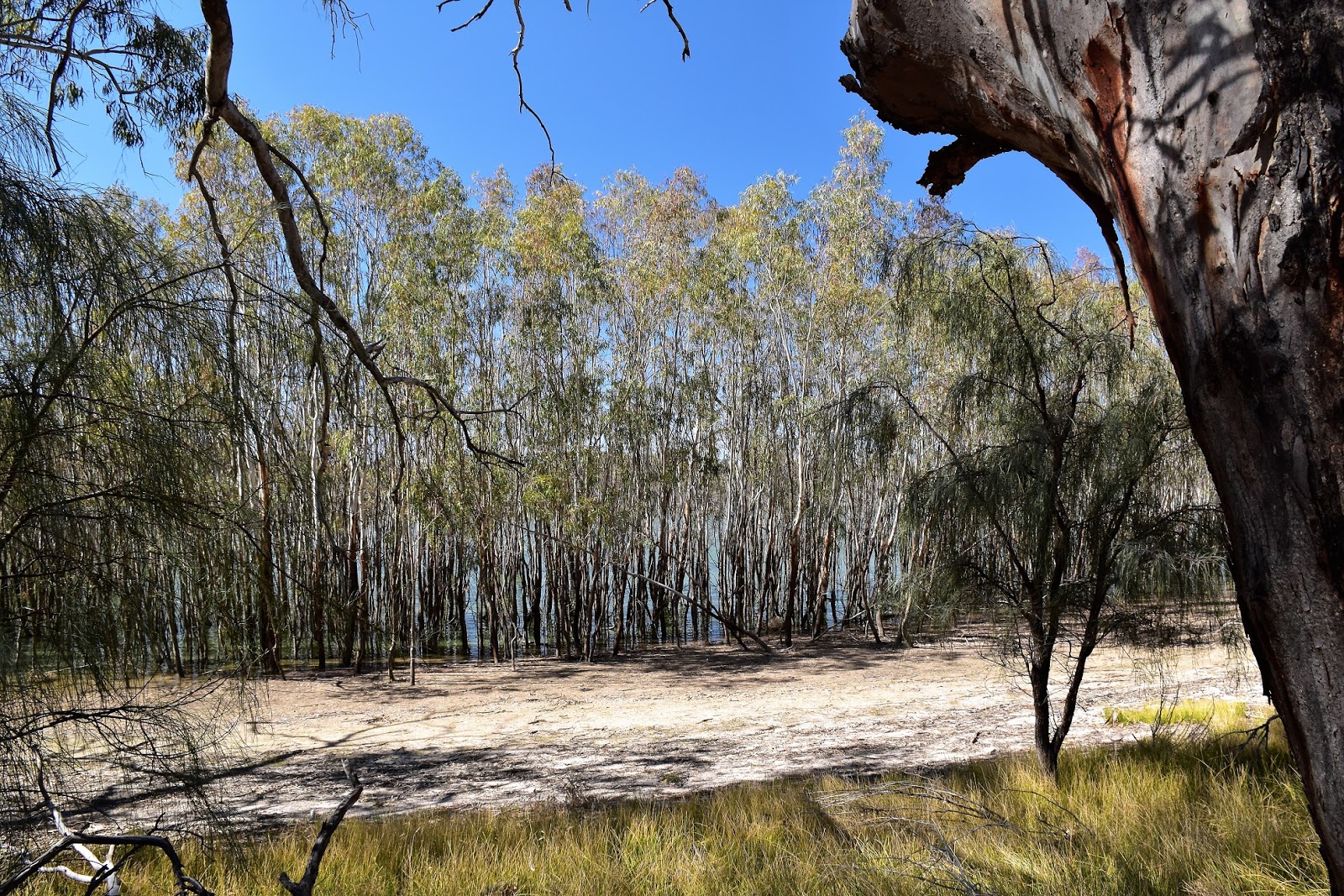
| The walk starts from the Hattah Lake Campground. |
Setting off this morning, we (yep, I’d roped Sam in) soon crossed the regulator between Lake Hattah and Little Lake Hattah, this was the spot that flooding had stopped me previously but there was no water flowing between the lakes on this visit. Almost as soon as we’d crossed the bridge the track moves a little bit north of Lake Hattah and strikes off to the east. The walking along here is through open red sand country, the track following a long low ridge. Apart from the kangaroos and emus the other point of interest now was Lake Bulla to the south of me, like Lake Hattah the Red Gum lined Lake Bulla had a good amount of water still in it.
 |
The regulator between Lake Hattah on the right and Little Lake Hattah on the left is the spot that has been flooded on my last couple of visits.
 |
I'm guessing that these Red Gums germinated after the man made 2010 environmental floods.
 |
| I'm not sure how old these mature Red Gums are.....lets just say that they are bloody old! |
|
|
With the temperature this morning in the high teens, virtually no wind and a perfect blue sky overhead it was hard to think of anywhere I’d rather be really. The shimmering water of Lake Brockie marked the spot that we’d leave Bugle Ridge Walk and turn hard left onto Brockie Track. This is the spot you can short cut the walk (the way that I walked with my nephew years ago) if you go right instead of left. Continuing on again we soon started to cross a few very small red sand dunes as Brockie Track skirted around yet another fresh water lake, this time Lake Tullamook. After a bit of a dog leg Brockie Track arrived at a t-intersection and we turned south along Nip Nip Track, we were now well and truly in red dirt country.
 |
Heading away from the lakes things dry out pretty quickly.
|
It wasn’t just the colour of the sand that was of interest here though, Nip Nip Track was also tracking along beside the Kangaroo Fence. The Kangaroo Fence is around 34 kilometres long and it runs around most of the lakes, the fence was built to stop the kangaroo population from sky rocketing in good seasons when the lakes hold water. After tracking south beside the fence line for around a kilometre Nip Nip Track swung around and started heading in a SSW direction, the Red Gums now mostly gone, we were now walking through a lightly timbered Black Box forest.
 |
Brockie Track heads across some low dunes, but it's all pretty easy.
 |
Brockie Track gets fairly close to Lake Tullamook along here.
 |
Lake Tullamook
 |
We headed south along the sandy Nip Nip Track beside the Kangaroo Fence.
 |
| The Kangaroo Fence. |
|
|
|
|
We felt a million miles from anywhere along here as we shuffled along the sandy track but the sound of the occasional truck rumbling along the nearby Hattah - Robinvale Road shattered that illusion. After meeting up with the Bugle Ridge Walk again (the other end of the short cut) we set off to cross a large flood plain to the south of Lake Arawak, this flood plain makes for desolate walking, the grey dirt and sparse covering of Black Box trees not doing much to soften up the scene in front of us, thankfully it wasn’t hot today as this bit of the walk would be desolate indeed in hot weather.
 |
Nip Nip Track
 |
The trees were mostly Black Box along here.
 |
| Things were a little desolate crossing the floodplain near Lake Arawak. |
|
|
Eventually the track started to climb a little up onto some red dirt, ahead of us once again was the Kangaroo Fence. A few hundred metres after meeting the Kangaroo Fence we met up with the gravelled Hattah Lakes Nature Discovery Drive, we’d now be more or less following this dirt road back to the ute. The Hattah Lakes Nature Discovery Drive tracks along the southern shore of Lake Hattah, the dirt road making for very easy walking with almost a complete lack of traffic. The Hattah Lakes area was the original home to the Jarijari Aboriginal People and there is a bit of evidence left over from their time living here, one of the best examples of that is the Canoe Tree. As the name suggests this large Red Gum on the shore of Hattah Lake has a big scar on it from where the local indigenous people cut a canoe from it.
 |
Approaching the Kangaroo Fence again.
 |
 |
We followed the Hattah Lakes Nature Discovery Drive for the last couple of kilometres back towards the ute.
 |
| The Canoe Tree beside Lake Hattah. |
|
|
|
It’s not only indigenous history up here though, moving a bit further along the shoreline we arrived at the pump house and pipeline that used to supply water from Hattah Lake to Hattah railway station for the boilers on the steam powered trains that used to ply their trade up and down the line. After checking out the old pump house we climbed over a slightly higher dune that allowed for a reasonable view down to Hattah Lake and then dropped down to the Visitor Centre. Whilst most of the national park visitor centres are rarely staffed now days, they are generally open and are worth checking out and Hattah Lakes Visitor Centre was no different on both counts. Suitably enlightened after our little break at the visitor centre all we had to do was wander a few hundred metres back towards the Hattah Lake Campground and the ute, to add a little interest to the last short section we dropped down onto the sandy shore of the lake for the last few hundred metres. Trudging along the soft sand under the huge old Red Gums with a nice gentle zephyr blowing of the lake life was pretty sweet.
 |
Wildlife is a bit of a feature of this walk, makes you wonder why I didn't get any decent photos.
 |
The water pump (well bits of it) that was used to pump water from Lake Hattah across to Hattah Railway station back in the days that steam powered trains ran up and down the line.
 |
You wouldn't want to be relying on water from the lake nowadays.
 |
| Heading back to the Lake Hattah Campground along the park access road. |
|
|
|
The Dirt.
According to my GPS we walked around 15.3 kilometres and climbed 119 metres on this easy walk. We used the map and notes out of Mr Tempest’s book
Daywalks Around Victoria, it’s walk number 12 in his book. Mr Thomas among others, has also written up this walk. We also used Meridian Maps
Hattah Lakes Sheet along with my GPS topo maps. The tracks on this walk are all well signposted and clear so navigation shouldn’t be an issue. You need to carry all your water requirements for the complete walk, whilst the lakes currently have water in them I wouldn’t be keen to drink it, Blue-Green Algae can be a real issue up here. If, like me, you are partial to Australia’s arid and semi arid country then this walk is definitely one to have on your to do list, I like it that much I’m hoping to head back up in a few weeks to do a more adventurous three day walk….we’ll see.
Relevant Posts.
Lake Mournpall Circuit, Hattah~Kulkyne National Park, 2017.
Warepil Lookout Circuit, Hattah~Kulkyne National Park, 2017.
Hattah Nature Walk, Hattah~Kulkyne National Park, 2017.
 |
| Lake Hattah |
 |
| We walked the last few metres along the shoreline before cutting up to return to the ute. |


No comments:
Post a Comment