 |
| I was walking through a green world this afternoon. |
Casting around this week for a stroll I eventually settled on revisiting another walk that I’d done years ago, the Tanglefoot Walking Track. No one has written notes on this walk for awhile as far as I can see and with the walk mostly being within Toolangi State Forest, which is a working forest (‘working forest’ is a more palatable phrase than ‘logging area’) I was expecting a few changes on the ground this afternoon. As usual by the time I’d done a little time at work and sorted out a few things in Melbourne’s Eastern suburbs it was after 12 by the time I actually set off on this stroll, with Mr Tempest’s old notes suggesting I had around 20 kilometres in front of me it looked like I was in for a solid afternoon.
 |
| Tanglefoot Carpark |
Leaving the ute I was enveloped in a world of green within two minutes, and really with the possible exception of my side trip up Mt St Leonard, I would be enveloped in that world until I’d get back to the ute much later this afternoon. Climbing away from the car park the track rose fairly easily up towards an intersection with my return route, the Myrtle Gully Track. I was now rounding the 1009 metre Mt Tanglefoot to the west of the summit, although really the dense vegetation means that unless you are concentrating on your map or GPS you’d be hard pressed to realise. After hurdling a few fallen trees, always something that I enjoy, I arrived at Myrtle Track and headed off along the left hand fork.
 |
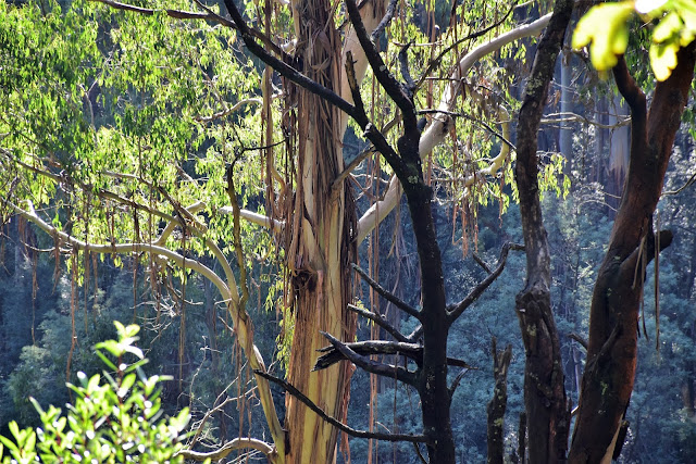
The tracks today were fairly clear for the most part, with only a few trees down.
 |
If you are not a fan of big trees and ferns then maybe give this post a miss.
|
|
I’m thinking that the walking track along here has been re-routed away from the ridge line a bit, the forest to my east on the other side of the ridge having been extensively logged. My map suggested that between the Myrtle Track and Monda Track was a fairly strait forward walk, and I suppose it probably was overall, but there are a couple of things to watch out for along here. The main issue along here is that there is a lot more tracks criss crossing this forest than shown on my notes and map and the signposting, where it exists isn’t always crystal clear, there are enough hints around that you can easily enough stay on the correct route but I definitely needed to pay attention to my map. To cut a very long and boring story short the go along here is to keep left at any intersection of tracks, anything leading off downhill to the west are generally short cut link tracks down to Myrtle Gully or Silvia Creek. Having said that, there are a couple of closed management tracks climbing eastwards off the route as well and you need to avoid them too, these closed tracks are all sign posted from what I can recollect though.
 |
These section of duck boards are incredibly slippery at this time of the year.
 |
There's even a picnic table and shelter just off the track, Parks Vic have spent a fair bit of money along here.
 |
 |
| Quite a few of the gullies had small streams cascading down them today. |
|
|
|
So anyway, apart from the navigation conundrums the walk over to Monda Track was pretty good, the track rose and fell a bit as I made my way along under what was now a beautiful blue sky, the weak late autumn sun making for almost the perfect temperature for a walk. With the track crossing a fair number of ferny gullies along here there were a few damp spots and surprisingly a fair bit of duck boarding, even more surprisingly all the duck boards on his walk (and there ended up being a fair bit) had their chicken wire removed from them, in a lot of spots I could see where the chicken wire was originally nailed down onto the timber but it was all gone now. So, with nothing to help my boots grip the slick wooden duckboards and bridges, it required a bit of concentration to negotiate them safely, it’s a bit of a strange situation really.
 |
The track contours just to the west of the ridge line for the most part on the way to Monda Track allowing for some views down into the valley of Sylvia Creek.
|
Apart from stopping to take the occasional photo I wasn’t mucking about this afternoon but even so it was well after 2pm when I finally emerged from the wall of green scrub onto Monda Track, I now had a choice as to whether to make the side trip up to Mt St Leonard or to start heading back in the direction of the ute. With such a beautiful day I figured that it would be a shame not to go up to the lookout this afternoon, figuring that as a worst case I’d be finishing my walk by head lamp I headed up Monda Track towards the lookout. This little side trip not only added a few kilometres and the best part of an hour to my walk, but also involved a reasonably solid climb of a bit over 100 metres as well. There are two options climbing to the Mt St Leonard Lookout from the Monda Track Carpark, the easiest option is to climb the fire spotters access track but the quickest way is to head up the steep grassy fire break that heads straight for the summit, being a hard core, supremely fit bushwalker (cough…) I took the short and steep route.
 |
Monda Track
 |
Climbing up to Mt St Leonard I entered the Yarra Ranges National Park for a short stretch.
 |
This little side trip is a steep little climb.
|
|
|
Mt St Leonard is a decent height summit, my notes say it’s 1027 metres and the Parks Vic signposting has it at 1010 metres with my GPS splitting the difference, who knows? What I do know though is that it’s not a wilderness type of summit, the top of the mountain is home to all sorts of industrial looking infrastructure, from a large fire spotters tower to numerous communication installations, not to mention the lookout itself, this isn’t a spot that I normally hang around long at. The view today down over the Yarra Valley was pretty sweet though so it was definitely worth the detour this afternoon, even if I did suspect that I’d now be finishing my walk in the dark.
 |
Looking back from Mt St Leonard towards Mt Tanglefoot, my walk started on the far side of that mountain.
 |
The Yarra Valley from Mt St Leonard.
 |
Where not talking pristine wilderness on the summit of Mt St Leonard.
 |
| It wasn't me....honest. I tend to agree with the sentiment though! |
|
|
|
Retracing my route back down Monda Track I picked up the old Quarry Road (signposted as Tanglefoot Track) and started a fairly long, but pretty gentle walk down towards Wirrawilla Carpark. This old road made for easy walking as it dropped into a valley, crossing the headwaters of Sylvia Creek on the way before tracking along just above the creek all the way down to the Wirrawilla Carpark. The old road can get a little slippery and muddy though, so I was pretty happy to have my walking poles with me this afternoon. Those link tracks that I talked about earlier come in from the right along here so avoid any tracks heading up hill to the east and keep deciding all the way to the car park and picnic area. While this walk was a little slippery, it was a magic section of today’s stroll, the late afternoon sunlight sending shafts of light through the misty forest as the temperature started to go down along with the sun.
 |
There is a nice little dam where the old Quarry Road leaves Monda Track.
 |
Quarry Road has been closed for a long time.
 |
The sun was slowly dropping down below the surrounding hills.
 |
The temperature was going down with the sun.
 |
| Sections of Quarry Road were a little muddy and slippery but for the most part it was pretty good. |
|
|
|
|
Bottoming out I emerged from the bush at the Wirrawilla Carpark and Picnic Area, once again my map had little in common with what I was seeing on the ground but things are fairly well sign posted along down here. Heading off I checked out the short Wirrawilla Rainforest Walk, this little strolls a must do if you are in the area I reckon, Parks have spent a motza on infrastructure here with a boardwalk, duck boards and bridges snaking their way up and down the incredibly green and lush little gully, there is even a little grand stand to stop and take in mother nature’s cathedral. It’s incredibly dark in here though so I’m thinking if photography is your thing then a tripod is the go, I switched my camera to ‘night landscape’ mode to get a few washed out photos but they definitely don’t do justice to this magic spot.
 |
Walking the Wirrawilla Rainforest Loop it was a good as dark
 |
 |
This little rainforest walk is a must do I think.
 |
I was using all my photographic trickery to get photos in here this afternoon.
 |
| You don't see a grandstand on many walks! |
|
|
|
|
By the time I emerged from the Wirrawilla Rainforest Loop and found the continuation of my stroll it was getting pretty close to 5 pm, picking up the Myrtle Gully Track I started up the fairly long climb back to the ute. Once again the track up here was pretty straight forward as it climbed, initially the track climbed just above Myrtle Gully, the cascading creek being heard and seen through the trees in many spots even though it was a good as dark now down in this remote gully. Being relatively close to the creek meant that for the first time today I was pushing through overhanging ferns as I climbed too, so it almost goes without saying that I picked up a leach somewhere along here!
 |
Heading up the Myrtle Gully Track, I've still got a fair way to go and it's basically dark.
 |
| Great, I've picked up a hitch hiker. |
|
By the time I met the short spur track that would take me back down to the ute at the Tanglefoot Carpark it was for all intents and purposes dark. With the circuit now complete though I was just retracing my earlier route, so apart from the danger of tripping up and going arse over on the fallen trees, I didn’t have much to worry about on this short section. With almost full loon lighting my path in weak light I emerged from the scrub onto the lawns of the Tanglefoot Picnic Ground, the ute easily visible in the carpark. Wandering the last few metres to the ute I started to get ready for the drive home, pulling off my gaiters to find three leaches attempting to use me for a free feed, unfortunately for me and one of the leaches my gaiter had squashed it, these are always the bites that get infected I think.
 |
Climbing up the Myrtle Gully Track, there was a bit of over hanging vegetation on this section.
 |
| Believe it or not the camera is brightening up the scene a bit, the track was pushing through these ferns. |
|
The Dirt.
Now while it might not come across in my waffling commentary I really like this walk, a little like Tarra-Bulga, the cool temperate rainforest and Mountain Ash are very impressive here. The other good thing with this walk is that the tracks are generally fairly clear of scrub (well they were when I went through on this visit anyway). Parks Vic have spent some money on this walks as well, there is quite a bit of infrastructure in the way of boardwalks, bridges, duck boards. There are a few tracks in the area that aren’t mapped though so you need to keep a bit of an eye on the navigation side of things. There is a picnic table just off the track on the way to Monda Track and also down at Wirrawilla Carpark, where there is also a toilet. Tanglefoot Carpark also has picnic tables and a toilet for before or after the walk. The most recent walking notes I can find for this walk are Mr Tempest’s notes out the second (2005) edition of Daywalks Around Melbourne, it's walk number 58 in the book. For such a good walk it’s a little surprising that no one else has written it up. My GPS had me clocking up 27.3 kilometres and climbing 741 metres this afternoon and while I think that is maybe a little over the odds it’s not too far out, I only stopped for a break once up on Mt St Leonard and for the rest of the day I was shuffling along at a fairly solid pace. I’d rate this walk as a Medium-Hard grade walk I’m thinking.
Relevant Posts.
Mt St Leonard, Yarra Ranges National Park, 2015.
Monda Track, Toolangi State Forest, 2017.
Morleys Track, Yarra Ranges National Park, 2017.
 |
| I've just popped out of the bush onto the grass picnic area at the Tanglefoot Carpark, the fairly full moon meant that I never had to drag out my head torch tonight. |
 |
| These are the ones that always seem to get infected. |


No comments:
Post a Comment