
Carnarvon Great Walk.
It looked a fairly easy day on paper today, so I was in no hurry to crawl out of the tent. By 8 am however I decided that I'd better make a move, the warmth of the sun was starting to heat up the inside of the tent nicely, so after a couple of minutes staggering around relearning how to stand I was ready for the day. The first objective of the day was brekky, followed by the tent drying game where I had to continually move my tent around to keep it in the sun to try and dry off all the dew. By 10:00 am the tent was still wet but I'd had enough of the game so it was time to pack it up and head off.

Gadd's Camp

Gadd's Camp
Initially I had quite a few kilometres on a management track this morning. Even though the track was tending gently uphill it provided for fairly easy walking. Initially I followed the east branch of the Maranoa River which was more or less bone dry, before I then followed Angelina Creek which was where I stumbled upon my utopia, yes a waterhole full of cool clear water that was deep enough to swim in. Quickly dropping my pack and stripping off I plunged in, immediately feeling better as a couple of days of accumulated grime and sweat was washed off. After swimming for awhile it was then time to bask on the rocks and dry off. Whilst basking like a lizard on the rocks I met the only other walker that I'd see in four days, he was on his own and had camped with Steve and Kim last night and was doing the walk in the opposite direction to me.


The day started with an easy climb up a closed 4wd track.

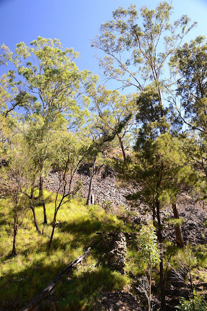
I was following the dry bed of Angelina Creek up the valley.


It was around now that I was starting to dream of a cool swim.

This'll do!

Angelina Creek made for a nice spot for a quick swim.


Enjoying the cool rock pool on Angelina Creek.
After my swim it was time to continue my journey up the management track heading to a lookout at Yurdu Bluff that was marked on my map. The track started to zig zag steeply as I gained height, however it was only a fairly short pinch and I was soon at the lookout. The lookout had a view into the head waters of the gorge as well as to the south west towards Mount Moffet. As lookouts go it was OK but I'd been spoilt so far on the walk. After taking in the views for awhile I once again started down the track. I'd decided that I'd stop for lunch where the walking track leaves the management trail and after descending for a kilometre or so I was at the junction and pulled up for lunch.


Late morning found me climbing steeply up an old 4wd track.

Mt Moffet.


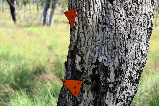
The track is reasonably well marked.

Lunchtime.
Due to my reasonably tardy start I could see that I'd be walking into the setting sun again as it was now close to 2 pm and I still had around 10 kilometres to camp. It was nice to be pushing through the grass again after the hard surface of the road though, as the track was much like yesterday afternoons route in that I was following wide open valleys and the occasional creek in a generally westerly direction. The only difficulties I encountered was where pigs had dug up large sections of the ground completely obliterating the track, and where fires had gone through wiping out the markers. Having said that the route was fairly easy to follow, I only had to scout around once or twice and really I'd prefer a bit of a challenge than to be following a motorway.

After lunch I was back on single track again.


Carnarvon Gorge National Park was looking sensational on this visit.


Walking into the low sun.
It was indeed late in the afternoon when I arrived at the rather substantial suspension bridge that led to the West Branch Walkers Camp. West Branch refers to the west branch of the Maranoa River over which the bridge crosses and the camp is situated. Once again the river was bone dry although after a bit of hunting around I did find some water however it didn't look very tempting for a swim. Pitching my tent in the huge grassy area near the bridge, I had about an hour to cook dinner before it got dark and the mozzies came out. Apart from a tap the West Branch Walkers Camp had no facilities, however there was a car camping area a couple of hundred metres away with a toilet. It was interesting to note that it was a 300 kilometre plus drive from here back to Carnarvon Gorge where I'd started the walk, and a fair section of that would have been slow going on dirt tracks.


There had been a bit of prescribed burning over near West Branch Camp.

Crossing the West Branch of the Maranoa River.

The Dirt.
According to my GPS I walked around 19 kilometres and climbed about 412 metres on what I'd call a medium grade days walking. Today was a mixture of walking tracks and closed 4wd tracks which were all well signposted and marked. When I went through it was early in the dry season and there was a bit water about althugh I'm thinking that things would get pretty dry later in the season. I used the Carnarvon Great Walk topo and my GPS on this walk.
Relevant Posts.

There was a car camping area a few hundred metres away that had water and a long drop.


Looks like it's almost tent o'clock.


That's it for me...see you tomorrow.


No comments:
Post a Comment